full power

FollowMe GPS tracking has global coverage, so it can be used anywhere. All you need is a GPS tracker (can be rented) to operate. No additional hardware or sophisticated management is required. We are using our own long-term racing experience and have the same goal as you – to be the best.


Global Coverage

Depending on the area, we use different GPS trackers – satellite and mobile. More about trackers. Optionally, we also provide a chip timing system. Chips and trakcers can be used separately or together.
  • Smooth integration – data from all devices are displayed on one platform
  • 12 language mutations reaches audiences all over the globe
  • Trackers are lightweight, durable, with long battery life and can send data from anywhere in the world
  • All devices include an SOS button for calling emergency help
  • Both spectators and the organizer have a constant overview of what is going on
  • As a complementary service, it is possible to use mobile chip timing
  • You can use our with your own satellite trackers (SPOT, InReach, YellowBrick…)

Online tracking

The GPS tracking web page becomes the main place where spectators follow the race. It is an ideal place for promoting the race partners. Races using GPS tracking attract many times more spectators, participants and sponsors (proven). GPS tracking facilitates organization and significantly increases security.
  • The position of competitors and teams is displayed on the online map in real time.
  • Online tracking allows you to go back in time, replay the entire race or view the completed tracks of selected competitors.
  • Modern and clear design, competitor profiles, photos from the course, daily news and videos together create an interactive portal
  • The GPS tracking platform is adapted for the promotion of race partners – links, logo, videos – all this can be added to the application
  • Integration with social networks
  • Higher engagement of fans, a community around the race is formed and is an interesting target group for sponsors.
  • Tracking can be viewed on any device – no app required.
  • The system uses multiple map sources (e.g. Mapy.cz) and can load routes from a GPX file.
  • Routes can have different formats – a fixed route, route choices, free order/point race, a stage race, multiple disciplines and others.
  • Information about the battery level and the time of the last position add to the the complete picture of the action.

Leaderboard

FollowMe can calculate results from various data – from virtual controls as well as physical controls with RFID chip timing. Any number of virtual controls can be created on the route. If the competitor approaches the virtual control, FollowMe will record his time.
  • Virtual checkpoint do not require any hardware – they can be created anywhere along the route. Thanks to this, split times can be recorded even in very remote places.
  • Time at CPs or split times- reliable and accurate results are complemented by GPS tracking.
  • We can evaluate races of all formats: fixed route or route choices, free order, point or stage race, individual start, start in waves, penalties and more.
  • Results, split times and tracks of competitors can be exported to various formats or printed.

Administration

As part of the service, we take care of creating and setting up the race, and the organizer does not have to deal with it. We provide support throughout the entire race. However, if the organizer is interested, he can be in control of everything. All the work with FollowMe takes place in the administration interface, thanks to which the organizer has full control over the race. In the administration, you can freely set modules for checkpoints, calculate results or enter information about the track and competitors. It is a complete ecosystem for organizing a race, from registration to exporting results and completed routes.
  • Setting race type, routes, checkpoints, disciplines, teams, categories and much more
  • The built-in application system simplifies the management of trackers and competitors
  • Making changes is easy – DNS, DNF,
  • Route changes (shortening), changing trackers, moving controls or deactivating them – all in real time
  • Custom logo, texts, colors – The design of the platform can be completely customized with CSS styling and embedded into your site
View demo

Tracker

A GPS tracker is a small device with a GPS chip. It receives location information and sends it to a server (using a mobile or satellite network). Thanks to the use of both types of devices, we can ensure coverage anywhere in the world. When using a device with mobile data, there is no need to have a signal everywhere. The device will send the data later and the track will be updated. The system can use complementary chip measurement.

feature-tracker

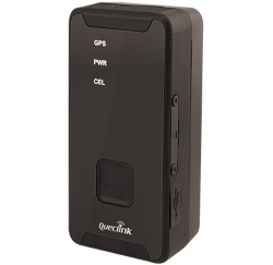
Queclink GL310MG mobile tracker

  • A reliable tracker for races in areas with mobile signal.
  • Durable and lightweight device – only 98 g.
  • Wide range of settings (interval 1s to 12h).
  • With location updates every 2 minutes, lasts over 120 hours (compared to the commonly used GL300 trackers with half the duration).
  • Best possible coverage – uses 2G, 3G, 4G and LTE networks.
  • We provide accessories for attachment to proven places that do not hassle the competitor.
  • SOS button to call for help.
  • Easy charging with USB-C cable.
  • Cheap solution.
  • Note: We use special SIM cards in the tracker that can connect to the network of all available operators around the world. Thanks to this, it handles border areas well.
feature-tracker

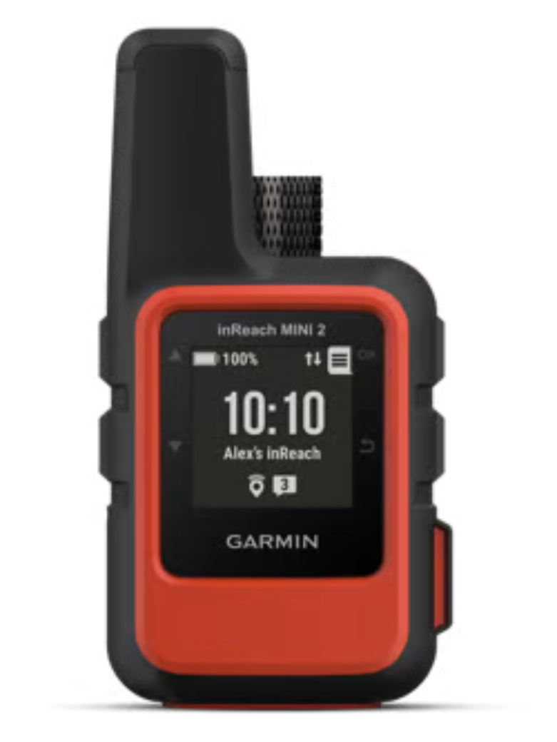
Garmin InReach Mini 2 satellite GPS tracker

  • The most reliable tracker for remote areas without mobile signal coverage.
  • Works as a two-way communicator – can receive and send messages. This enables communication between trackers, sending regular SMS, emails and posts on social networks.
  • Uses all navigation systems – GPS, GLONAS, GALILEO and BeiDou and has an accurate compass.
  • Works worldwide, including oceans and polar regions.
  • Enables basic navigation – navigate to a point, navigate along a route or back to the starting point.
  • When paired via the application on the phone, you can write messages on the mobile phone and send them via satellite.
  • Sends location every 10 min (can be set to 2 min interval for extra fee).
  • SOS button to call for help in an emergency.
  • Waterproof, durable and weighs only 100g.
  • With updated every 10 minutes, it will last over 5 days
  • Easy and fast charging with USB-C cable.
  • Note: Garmin trackers use the Iridium network, so they work all over the world, including polar regions and oceans. This differentiates them from SPOT units which utilize by ground stations to broadcast and are not working in many parts of the world due to the current situation (war).